Mendoza field guide
Mendoza Wine Regions: A Field Guide to the Five Zones
Mendoza is not one vineyard with one style. This is a practical map of its five official zones, the conditions that distinguish them, and where San Rafael belongs.
Research note: Zone boundaries follow Argentina's Instituto Nacional de Vitivinicultura (INV). Vineyard-area figures use the INV 2025 surface report; older zone reports are identified where they supply landscape context.
The short answer: Argentina’s Instituto Nacional de Vitivinicultura divides Mendoza into five statistical winegrowing zones: North, Center, East, Uco Valley, and South. Luján de Cuyo and Maipú are both in the Center zone. San Rafael is in the South. These zones are useful for orientation, but a bottle’s style still depends on the particular vineyard, grape, season, farming, and winemaking.
In 2025, Mendoza held 140,682 hectares of vineyard, or 71.7% of Argentina’s vineyard area. That number describes planted land, not Mendoza’s share of finished wine. It also hides extraordinary variation. Vineyards spread across irrigated oases beside the Andes, from the northern edge of the province to San Rafael and beyond.
If you have seen Mendoza presented as only Luján de Cuyo and the Uco Valley, this guide fills in the rest of the map. It also separates two ideas that are often mixed together: the INV’s five-zone statistical framework and the smaller geographic indications that can appear on labels.
A reader’s map of Mendoza wine country
Orient yourself from Mendoza city. The North zone lies above and around the northern metropolitan edge. The Center extends south and southwest through Maipú and Luján de Cuyo. The East opens onto the broad plains east of the city. The Uco Valley sits farther southwest against the Andes. The South is a separate oasis several hours away, centered on San Rafael and General Alvear, with Malargüe included in the current INV statistical grouping.
Orientation plate · 02
Five statistical zones, one varied province
- 01 North Lavalle · Las Heras
- 02 Center Luján de Cuyo · Maipú · Guaymallén · Godoy Cruz
- 03 East San Martín · Junín · Rivadavia · Santa Rosa · La Paz
- 04 Uco Valley Tunuyán · Tupungato · San Carlos
- 05 South San Rafael · General Alvear · MalargüeSan Rafael highlighted
Capital is shown in neutral because it is not assigned to one of the five zones in the INV’s definitive 2022 department table.
On a phone, swipe the table horizontally to see every column.
| INV zone | Departments in the official framework | Elevation and landscape, at guide level | What to remember |
|---|---|---|---|
| North | Lavalle, Las Heras | Arid northern oasis and plains; elevation varies sharply as Las Heras runs toward the Andes | A large, warm, dry area that cannot be reduced to a single wine style |
| Center | Luján de Cuyo, Maipú, Guaymallén, Godoy Cruz | Long-established irrigated land; Luján’s piedmont vineyards extend above roughly 850 m | The historic core, including Luján and Maipú |
| East | San Martín, Junín, Rivadavia, Santa Rosa, La Paz | Broad, generally lower plain; an INV report places much of the zone around 600–700 m | Mendoza’s largest statistical zone by 2022 vineyard area |
| Uco Valley | Tunuyán, Tupungato, San Carlos | Andean valley and alluvial fans; an INV regional report uses roughly 900–1,250 m as a general band, while individual vineyards can sit higher | High site variation, cool influences, and strong subregional identity |
| South | San Rafael, General Alvear, Malargüe | Distinct southern oasis supplied by the Atuel and Diamante rivers; elevations differ by district and vineyard | San Rafael is here, not in the Uco Valley |
The table is an orientation, not a substitute for a vineyard address. Department boundaries cover large areas, and the useful question is rarely just “How high?” It is “Where exactly, on what soil, with what water, aspect, grape, and farming?” Our high-altitude Mendoza guide explains those mechanisms in detail.
Why “Primera Zona” is not a sixth zone
Primera Zona is a historic wine term, commonly associated with the established quality vineyards of Luján de Cuyo and Maipú. It is narrower than the INV’s full Center zone. Treating Primera Zona as a sixth official statistical zone creates a map that does not match the agency’s framework.
The distinction matters when you compare sources. A tourism map, an appellation map, and an INV statistical table may divide the province for different purposes. None is automatically wrong; they are answering different questions.
The five zones, one by one
North: Lavalle and Las Heras
The North zone combines Lavalle and Las Heras, two departments with very different internal geographies. Lavalle extends across dry plains north of Mendoza city. Las Heras reaches from the metropolitan edge toward high Andean terrain. A zone name this broad tells you where to begin, not what every glass will taste like.
Warmth, aridity, irrigation access, soil texture, and site exposure all affect what can be planted and how grapes ripen. The practical label-reading lesson is to look below “Mendoza” for a more precise origin whenever one is provided. A named district or vineyard is more useful than a generic assumption about northern wine.
For travelers, North is also different from the familiar winery corridors south of Mendoza city. This page stays focused on wine geography rather than maintaining a winery directory, which would date quickly.
Center: the historic core
The official Center zone includes Luján de Cuyo, Maipú, Guaymallén, and Godoy Cruz. Luján and Maipú carry much of the zone’s international name recognition, but the statistical area is larger than those two departments.
An INV regional report describes the Center’s vineyard soils as generally permeable and low in organic matter, with gravel and other coarse alluvial material important in parts of the piedmont. The Mendoza River and its irrigation network have made agriculture possible in an otherwise dry environment. That last point is fundamental across the province: Mendoza wine is an oasis story as much as a mountain story.
Luján de Cuyo
Luján de Cuyo lies south and southwest of Mendoza city, with vineyards extending onto the Andean piedmont. The INV notes vines above roughly 850 metres above sea level in that western setting. Malbec is deeply associated with the department, but altitude alone does not define Luján. Established districts, varied alluvial soils, irrigation, vine age, and producer choices all contribute.
On a label, “Luján de Cuyo” is more specific than “Mendoza.” A district or vineyard designation may narrow the origin further. Expect style to vary from supple and fruit-led to structured and cellar-worthy rather than assuming every Luján Malbec follows one template.
Maipú
Maipú sits closer to and east of Luján, with a long history of vineyards and wineries. It shares the Center’s broad desert-oasis conditions but contains its own range of districts and soils. Malbec is important, as are Cabernet Sauvignon, Bonarda, Chardonnay, and other varieties.
Maipú is often grouped with Luján under Primera Zona in wine conversation. That shorthand is helpful for history, but it should not erase their local differences. If you are tasting them side by side, hold grape and winemaking as constant as you can before assigning a contrast to geography.
East: the broad lower oasis
The East zone comprises San Martín, Junín, Rivadavia, Santa Rosa, and La Paz. In the INV’s 2022 zone table, it was Mendoza’s largest zone by planted vineyard area. That is a dated zone comparison, so it should not be substituted for a current annual total.
An INV report places much of Eastern Mendoza around 600–700 metres above sea level. It describes sandy-loam to sandy-silt soils, irrigation from the lower Tunuyán and Mendoza river systems plus groundwater, and more than 2,200 hours of sunshine during a favorable 210-day growing period. Salinity can be an issue in some places.
That context helps explain scale and farming, but “East” should not be treated as a synonym for basic wine. Large areas contain old vines, diverse grapes, and growers making different yield and quality decisions. Bonarda, Malbec, Syrah, Tempranillo, and traditional white and pink varieties all have a place in the zone’s vineyard history.
For a buyer, the useful move is the same: notice whether the producer gives you a department, district, vineyard, vine age, harvest, or élevage detail. Those facts tell you more than a hierarchy that automatically ranks one zone over another.
Uco Valley: three departments, many sites
The Uco Valley consists of Tunuyán, Tupungato, and San Carlos. It runs along the Andes southwest of Mendoza city. An INV regional overview describes a general elevation progression from about 900 metres near Tunuyán city to roughly 1,250 metres around Tupungato. Individual vineyards can lie above that report’s broad band; a published Malbec soil study, for example, examined a vineyard at 1,450 metres in Gualtallary.
The valley is not a single high-altitude flavor. Alluvial fans, slope position, soil depth, stones, limestone-rich material in some sites, cold-air movement, irrigation, and exposure can change within short distances. The three departments also contain recognized geographic indications and districts that producers may name on labels.
Malbec and Cabernet Franc receive much of the attention, while Chardonnay, Sauvignon Blanc, Pinot Noir, and other grapes can be compelling in suitable sites. A broad tasting tendency may emerge across a producer’s lineup, but it is safer to compare precise origins than to declare an “Uco style.”
For travel, Uco is a destination in its own right, not a quick extension of a city tasting room. Distances and appointment policies should be checked with current local sources. This guide does not attempt to rank wineries or promise hours that can change.
South: San Rafael, General Alvear, and Malargüe
The South zone is geographically separate from greater Mendoza and the Uco Valley. The current INV framework includes San Rafael, General Alvear, and Malargüe. Older INV reports sometimes describe the viticultural area through San Rafael and General Alvear alone, so always check the date and definition behind a table.
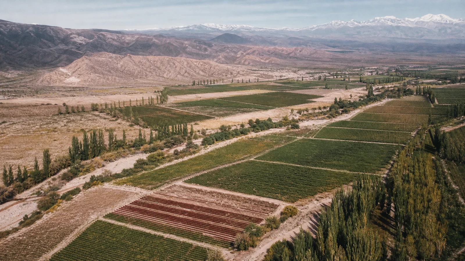
The established southern oasis is irrigated by the Atuel and Diamante rivers, whose water begins as Andean snowmelt. An INV report describes alluvial soils with frequent calcareous material and stony subsoils. Those are regional observations, not a promise that every vineyard has limestone or the same soil profile.
In the 2025 surface report, San Rafael contained 10,739 hectares of vineyard, including 2,152 hectares of Malbec. It represented about 7.6% of Mendoza’s vineyard area. Again, these are planted-area figures, not shares of production or quality.
San Rafael in focus
San Rafael has its own legally recognized denomination of origin. A reference point at 692 metres above sea level appears in the 2007 boundary resolution. That point helps locate the legal area; it is not an elevation claim for every San Rafael vineyard, nor does it mean that every wine made there carries the denomination.
San Rafael’s identity is not “Uco Valley, but farther south.” Its river-fed oasis, latitude, district pattern, established mixed agriculture, and generally different elevation context create a separate set of decisions. The useful comparison is not which region wins. It is how a grower matches grape, parcel, irrigation, canopy, crop level, and harvest date to a particular place.
That is also why Familia Morgan works in San Rafael. Our connection begins with a farm and winery there, and with people who stay close to the fruit rather than treating the vineyard as a supply line to the cellar. The place offers a grounded southern perspective on Mendoza: snowmelt water, dry air, long vineyard rows, and site choices that cannot be copied from a fashionable address elsewhere.
Mendoza regions compared by the questions that matter
| When choosing a bottle | Better question | Why it helps |
|---|---|---|
| Origin | Does the label name only Mendoza, or a zone, department, district, or vineyard? | More precision gives you a better basis for comparison |
| Elevation | Is a specific vineyard elevation stated, and in metres or feet? | Province-wide altitude slogans hide site variation |
| Farming | How is the site irrigated, and what does the producer say about soil and canopy? | Water and vine balance are central in an arid region |
| Grape | Is it varietal Malbec, another grape, or a blend? | Region and variety interact; one cannot stand in for the other |
| Cellar | Was it raised in stainless steel, concrete, old wood, or new oak? | Vessel and time can alter fruit expression and texture substantially |
| Year | What happened in that vintage, and when was the fruit picked? | Seasonal weather and harvest choice can outweigh regional stereotypes |
This is the difference between using a map and turning it into a ranking. Geography organizes the questions. It does not answer all of them.
Which Mendoza region should you explore first?
Choose based on the experience you want, then let the bottle challenge your expectations.
For historic context
Start with Luján de Cuyo and Maipú, then compare the districts and producers within the Center zone.
For detailed site study
Explore Uco Valley labels that identify a department, district, vineyard, soil, or elevation, and verify what each term means.
For a wider view of Mendoza
Taste East and North alongside famous western origins. Scale and warmth do not erase grower choices.
For Familia Morgan’s perspective
Look south to San Rafael and its Atuel-Diamante oasis, a distinct setting with its own agricultural history.
If Malbec is your route into the province, continue with our Malbec guide. When the question becomes which bottle offers useful evidence at an accessible price, use the affordable Malbec buying guide. If the mountain mechanism is the part you want to understand, read what altitude changes in a Mendoza vineyard. For the wider national context, see Argentina and Mendoza in the glossary.
Taste Mendoza from the south
Explore Familia Morgan wines connected to San Rafael, then use the vineyard and cellar details to decide what you want to compare next.
Sources and methodology
This guide prioritizes official boundaries and current planted-area data. Older INV zone reports are used only for geographic and agro-ecological context, with their dates and limits kept separate from 2025 figures.
- INV, 2025 Annual Vineyard Surface Report, database closed December 31, 2025 and published February 2026.
- INV, Viticultural Variables by Zone, 2022, for the five-zone framework and department assignments.
- INV, official Mendoza regional reports index, linking the Center, East, Uco, North, and South reports.
- Argentina’s GeoRef territorial dataset, based on IGN geometry, for the province and department outlines simplified in the orientation map.
- INV, Southern Mendoza regional report, for the Atuel-Diamante oasis and broad soil context.
- INV Resolution C.31/2007, for the legal San Rafael denomination boundary.